The Strip Walking Tour Guide: How to Cover It on Foot
How long does it take to walk the Las Vegas Strip?
The Strip runs about 6.8 km (4.2 miles) from Mandalay Bay to the Strat, and most visitors split it into two or three segments rather than walking it in one go. Each segment realistically takes 45 minutes to 1.5 hours of pure walking, before stopping for photos, casino interiors, or the heat.
Why the Strip is harder to walk than it looks on a map
Open any map of Las Vegas and the Strip looks like a single, walkable line of hotels stacked close together. On foot, it behaves differently. The corridor runs roughly 6.8 km (4.2 miles) from Mandalay Bay at the south end to the Strat at the north end, and almost none of that distance is a straight sidewalk. Casino resorts here are built as destinations to wander through, not obstacles to walk past, so a “quick” trip from one hotel to the next often means cutting across a lobby, a casino floor, and a retail promenade before you reach the street again.
Add pedestrian bridges at the major intersections (Las Vegas Blvd at Tropicana, Flamingo, and Spring Mountain among them), stairs or escalators to reach them, and — depending on the season — genuinely hot pavement, and the Strip stops being a stroll and starts being a planned outing. This guide breaks the route into logical segments, gives realistic walking times for each one, and separates free options (walking, casino trams) from paid ones (guided tours, transit) so you can decide how to spend your time and money.
The jurisdiction quirk almost nobody checks
Before the route itself, one detail worth knowing changes how you should read addresses and signage along the way: the Strip is not inside the city of Las Vegas. Nearly the entire resort corridor sits in unincorporated Clark County, specifically the towns of Paradise and Winchester, even though every hotel carries a “Las Vegas, NV” address and ZIP code. This goes back to 1950, when casino operators pushed for unincorporated status specifically to stay outside the city’s taxation and regulatory reach as Las Vegas tried to annex the area.
Downtown, by contrast — the Fremont Street district — really is inside city limits. If you’re walking the Strip and later add a Downtown leg, you’re crossing an actual municipal boundary, not just moving between neighborhoods with the same name. It rarely affects a visitor’s day directly, but it explains why some regulations, policing, and permitting differ between the two areas even though they’re a few kilometers apart and both say “Las Vegas.”
Segment 1: South Strip — Mandalay Bay to CityCenter
Realistic walking time: 45 minutes to 1 hour of pure walking, without stops.
This southern stretch runs from Mandalay Bay past Luxor, Excalibur, New York-New York, and the MGM Grand area up to CityCenter (Aria, Vdara, Park MGM). It’s one of the flatter, more straightforward legs, and it includes some of the Strip’s most photographed exteriors: the Luxor pyramid, the Excalibur towers, and the New York-New York skyline replica.
A few practical notes for this segment:
- The free casino tram connecting Mandalay Bay, Luxor, and Excalibur covers part of this distance if you want to save your legs early and walk the rest.
- The pedestrian bridge network around Tropicana Ave is one of the busier crossings on the whole Strip, since it links four major resorts at once; budget extra time here rather than assuming a quick pass-through.
- If sports or events interest you, this end of the Strip is also the closest to Allegiant Stadium, and a guided walking tour of Allegiant Stadium pairs naturally with a morning spent on this segment before the day heats up.
Segment 2: Center Strip — Bellagio to the Venetian
Realistic walking time: 1 to 1.5 hours of pure walking, without stops.
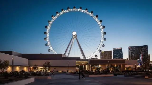
This is the segment most visitors picture when they think of “the Strip”: Bellagio and its fountains, Paris Las Vegas and its half-scale Eiffel Tower, the High Roller observation wheel at the LINQ, Caesars Palace, and the Venetian’s canals. It’s also the densest with free attractions worth stopping for, which is exactly why the walking-time estimate for this stretch is the longest of the three despite covering a similar physical distance to Segment 1 — the pull to stop is constant.
A few things worth building into your plan here:
- The Bellagio fountain shows, the Sphere’s exterior (visible from several points along this stretch), and the LINQ promenade all reward slowing down rather than rushing through, so treat the time estimate as a floor, not a ceiling.
- This is also the segment where a paid guided walking tour earns its cost most clearly, since a guide can route you efficiently between the free sights and add context — the history behind Caesars Palace’s design, why the Venetian built indoor canals — that a self-guided walk skips. A guided evening walking tour along this stretch is built around exactly this kind of pacing and route knowledge.
- The crossing at Flamingo Rd, linking Bellagio, Caesars Palace, the Flamingo, and the LINQ, is another elevated-bridge junction — expect stairs or an escalator, and don’t assume it will be quiet.
Segment 3: North Strip — the Venetian to the Strat
Realistic walking time: 45 minutes to 1 hour of pure walking, without stops.
The northern leg runs from the Venetian/Palazzo area up past Treasure Island, the Wynn and Encore, and the newer Fontainebleau, ending at the Strat’s tower. This segment is visibly quieter than the center Strip — sidewalks are less crowded, resorts are more spread out, and there’s a noticeably longer gap between major properties compared to Segments 1 and 2.
That spacing is the main thing to plan around:
- Because resorts sit farther apart here, there’s less incentive to duck into casino interiors to break up the walk, so more of this segment is genuinely outdoor pavement. In warm weather, that makes hydration and shade planning more important on this leg than on the denser, more air-conditioned-interior-heavy center Strip.
- The Strat itself sits at the effective north end of the Strip; Downtown/Fremont Street is roughly 2-3 km further north again and functions as a separate walk, usually reached by rideshare, bus, or a short additional walk rather than folded into the same outing.
- If your legs are done by this point, this is also a natural spot to end the day and use transit rather than walk back — see the comparison below.
Free walking and trams vs. paid guided tours vs. transit
It helps to separate three genuinely different ways of covering Strip distance, because they get conflated constantly:
| Option | Cost | What it actually covers | Best for |
|---|---|---|---|
| Walking (self-guided) | Free | Any distance, at your own pace | Full flexibility, photo stops, no fixed schedule |
| Casino-to-casino trams | Free | Only specific neighboring resorts (e.g. Mandalay Bay-Luxor-Excalibur, Park MGM-Aria-Bellagio) | Short hops between adjacent properties |
| Las Vegas Monorail | Paid (fare per ride/pass) | Behind the east side of the Strip, MGM Grand to the Sahara | Longer hops when you don’t need street-level sights |
| RTC Deuce / SDX bus | Paid (roughly $6 for 2 hours, $8 for 24 hours as of 2026) | Full length of the Strip and to Downtown | Covering long distances cheaply without walking |
| Guided walking tour | Paid, typically roughly $25-50 in 2026 | A curated route with commentary, sometimes skip-the-line access to specific spots | Context, history, and efficient pacing rather than just distance |
None of these is objectively “the right” choice for the whole day — most visitors end up mixing them, walking the segment they want to linger in and taking a tram, bus, or rideshare for the parts that are just transit between points of interest.
What a guided walking tour actually adds
A self-guided walk costs nothing but your time and gives you full control of the pace. A paid guided tour changes the value proposition in a specific way: rather than saving distance, it usually adds things a self-guided walker has to research separately — the story behind a hotel’s design, why certain landmarks were built where they were, and sometimes a more efficient route between stops than a first-time visitor would find alone. Pricing in 2026 for this kind of tour commonly runs in the rough $25-50 range depending on length and group size, though always check the current listing rather than treating that as fixed.
If your focus for the day leans toward food rather than landmarks, that same logic applies Downtown: a guided food walking tour through Downtown covers a completely different, much smaller footprint than the Strip segments above, and works well as a separate outing rather than an extension of a Strip walk.
For visitors who want to cover more ground than walking allows but still stay outdoors and self-directed, renting an e-bike is a middle option worth knowing about — see e-bike rentals for getting around the Las Vegas area for a faster, still-flexible way to move between segments without relying on tram routes or bus schedules.
Practical tips for walking the Strip in segments
- Don’t try to fix a single walking-time number for every visitor or every season. The 45-minute-to-1.5-hour ranges above assume moderate weather and a fit walker moving without long stops; hotter months, larger groups, or a more leisurely pace will push every segment toward the top of its range or past it.
- Wear real walking shoes, not sandals or dress shoes, even for an evening walk — casino floors and pedestrian bridges cover more distance than they look like they should, and there’s no guarantee of a bench or seating area when you need a break.
- Carry water on every segment, not just in summer. The region’s heat guide covers just how extreme conditions get in peak months, but even shoulder-season afternoons can be warmer than visitors expect on an exposed sidewalk with no shade.
- Plan pedestrian bridges into your time estimate, not around it. The bridges at Tropicana, Flamingo, and Spring Mountain are structural parts of the route, not shortcuts — assume stairs or an escalator and some waiting at each one, and don’t count on them being quiet just because a map suggests a short crossing.
- Treat Downtown as a separate trip, not a fourth Strip segment. The distance and the jurisdiction (city of Las Vegas vs. unincorporated Clark County) both change once you’re north of the Strat, and most visitors get there by rideshare or bus rather than adding it to the same walk.
- If you’re comparing this to other ways of getting around, the fuller breakdown of monorail vs. RTC bus vs. rideshare on the Strip and the general guide to getting around the Strip go into more detail on cost and coverage than the table above.
- If you only have one day for the whole area, the one-day Strip essentials itinerary sequences these same segments against a broader day plan rather than just the walking route.
Strip walking tour FAQ
Is the Las Vegas Strip actually in the city of Las Vegas?
No. Almost all of the Strip sits in unincorporated Clark County — specifically the towns of Paradise and Winchester — even though every address reads “Las Vegas, NV.” Only Downtown/Fremont Street is genuinely inside city limits. The distinction dates to a 1950s arrangement that kept the resort corridor outside city taxation and control; it rarely affects a visitor’s day directly, but it explains inconsistencies between Strip and Downtown regulation. For more on this, see the Strip vs. the city of Las Vegas.
How far is it to walk the entire Strip in one day?
About 6.8 km (4.2 miles) end to end, but that number understates the effort involved. Pedestrian bridges, casino interiors you often have to cross just to reach the street again, and desert conditions routinely stretch a “short” walk into two to three hours of net moving time, before any stops for photos or attractions.
Is there a free way to get around the Strip besides walking?
Only the casino-to-casino trams are free, and they connect specific neighboring resorts rather than the whole corridor — for example Mandalay Bay-Luxor-Excalibur, and Park MGM-Aria-Bellagio. The Las Vegas Monorail and the RTC Deuce/SDX buses both charge fares and are not free options.
Should I book a guided walking tour or just walk the Strip myself?
Walking it yourself is free and flexible, especially if you split the route into segments as outlined above. A paid guided tour, typically around $25-50 in 2026, adds historical context, efficient routing, and sometimes priority access to specific viewpoints — a reasonable trade if you want more than just the distance covered.
What is the best time of day to walk the Strip?
There’s no single correct answer — it depends on the season and your own heat tolerance. Cooler months make midday walking comfortable, while summer heat makes an early-morning or evening start far more sensible. Check the forecast for your actual travel dates rather than following a fixed schedule.
Can I walk between all the major Strip resorts without crossing streets?
Much of the route uses elevated pedestrian bridges at major intersections, which avoid at-grade crossings but add stairs or escalators and extra distance compared to a straight line. Expect some waiting at busier bridge entrances, though how busy varies by day and time.
Does the Strip walk include Downtown Fremont Street?
No. Fremont Street sits roughly 2-3 km north of the Strat and belongs to a genuinely separate district — inside the actual city of Las Vegas, unlike the Strip itself. Most visitors treat it as its own outing, reached by rideshare or bus rather than folded into the same walk.
How hot does it get while walking the Strip, and when should I worry?
Conditions vary enormously by season, from mild in winter to genuinely dangerous in peak summer, when daytime highs commonly reach 38-43°C (100-110°F). Rather than relying on a fixed rule, check the forecast for your dates and read the Las Vegas summer heat guide before planning a long outdoor walk in warmer months.
Las Vegas Walking Tours
Verified deep-linked GetYourGuide tours. Book through these links and we earn a small commission at no cost to you.
GetYourGuide does not provide a product photo for this activity — the image shows the meeting point, photographed by us.